Q: Are the Maps at the Beginning of Each LOTR Book Hand Drawn by Tolkien?
ANSWER: J.R.R. Tolkien did draw some of the maps that he used for his stories but his son Christopher drew the “final” maps used for publication in The Lord of the Rings. Both of the maps used in The Hobbit were drawn by J.R.R. Tolkien himself (his son christopher was too young at the time to assist in such tasks).
Some editions of The Lord of the Rings have included maps of Middle-earth drawn by other people. The only map that Tolkien himself specifically sanctioned and assisted with was the 1969 Pauline Baynes map of Middle-earth, which introduced several new place names (and at least one mis-spelling) into the Middle-earth lexicon. The Pauline Baynes map is the only non-Tolkien illustration used as an authoritative reference by Tolkien researchers when discussing Middle-earth as Tolkien himself published it.

Many artists have long since drawn their own maps of Middle-earth, some of which have been published in annotative books and essay collections. Those maps, while not canonical, serve to illustrate just how creative people can be in representing Middle-earth. The most widely published map of Middle-earth is probably the Ballantine map.

Many maps, particularly illustrated maps, introduce errors and inconsistencies into the cartography of Middle-earth. The most widely acknowledged cartographer, Karen Wynn Fonstad, has been criticized for not correcting errors in her Atlas of Middle-earth. According to Fonstad’s daughter, the publisher elected not to correct the maps despite Fonstad’s own desire to do so.
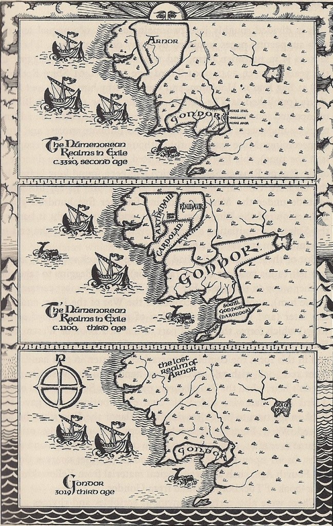
J.E.A. Tyler’s original Tolkien Companion was severely rejected by Tolkien researchers (he extensively rewrote the book after the publication of The Silmarillion) but it introduced highly stylized border maps depicting the Numenorean Realms-in-Exile to Tolkien readers. Information published in Unfinished Tales of Numenor and Middle-earth suggests that Tyler projected Gondor’s early western borders too far along the coast. However, many other illustrated maps are equally erroneous.

# # #
Have you read our other Tolkien and Middle-earth Questions and Answers articles?

[…] Are the Maps at the Beginning of Each LOTR Book Hand Drawn by … Many maps, particularly illustrated maps, introduce errors and inconsistencies into the cartography of Middle-earth. The most widely acknowledged cartographer, Karen Wynn Fonstad, has been criticized for not correcting … Source: middle-earth.xenite.org […]